Rainbow Mountain – 743m

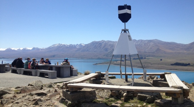
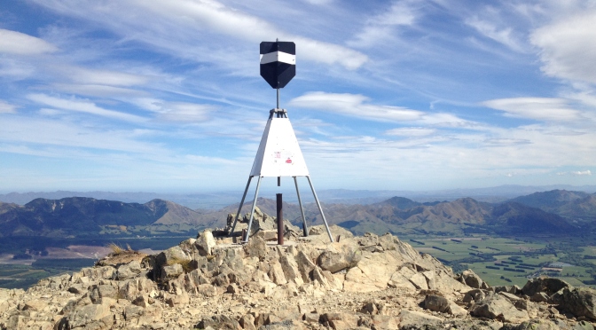
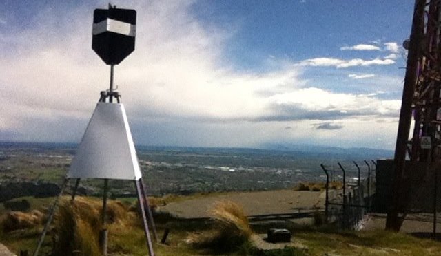
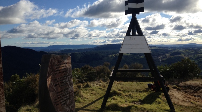
27th June 2015; Rotorua, Bay of Plenty.

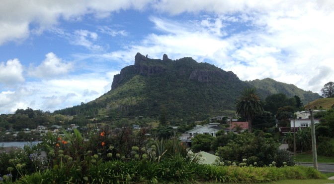
This is an awesomely beautiful climb set in the unique geothermal landscape of Rotorua. With the carpark at about 400m its a moderate ascent that takes about 1.5 hours.The area that you can see surrounding the mountain has some of the most unique geothermal sites in the world. The vegetation in the area is also very unique and you pass some beautiful blue geothermal lakes on the way up.

The mountain has both walking tracks and mountain biking tracks to get up to the summit and can be reached along the New Zealand cycle trail – Te Ara Ahi from Rotorua township.

After scaling this cracker peak take a soak in one of the regions many hot pools!! There is the Kerosene Creek swimming hole down the road for a free soak or the Waikite Valley Hot Pools where you can camp up for the night as well with a licensed café on site 🙂

Further information:

http://www.doc.govt.nz/parks-and-recreation/places-to-go/bay-of-plenty/places/rainbow-mountain-and-waiotapu-scenic-reserves/things-to-do/rainbow-mountain-summit-track/


Mt John – 1031m

26th October 2015; Mt John Observatory Area, Mackenzie.

This 300m ascent makes for an easy wee peak, but is by no means underrated for its views. And speaking of the views here – they just happen to be to die for not just during the day, but at night as well (so long as you get a cloud free night of course!).

The track to the top starts at the pool complex on the lakeshore in the Tekapo Village and takes you up through the forest on a well formed track. It eventually emerges not far from the top to give great views across the Mackenzie Basin for the last 10 minutes of the track. The track to the top will take you approximately 45 minutes. You can make this track a loop of about 3 hours by continuing along a track that heads down the other side of the hill and along the lakeshore to where you left off.

Bonus on this peak…. a café at the top for unbeatable coffee views!!

The track is suitable for all people and it’d be well suitable for walking at night – absolutely recommended given its right in the middle of a night sky reserve that encompasses the townships of Tekapo, Twizel, and Mt Cook. It has the clearest, darkest night sky in New Zealand and is considered to be one of the best stargazing spots on earth! Hence the observatory located at the top 🙂

Further Information:

http://www.doc.govt.nz/parks-and-recreation/places-to-go/canterbury/places/lake-tekapo-area/things-to-do/lake-tekapo-town-tracks/

http://www.livescience.com/20893-newzealand-dark-sky-reserve.html

http://darksky.org/idsp/reserves/

http://media.newzealand.com/en/story-ideas/aoraki-mackenzie-dark-sky-reserve,-nz/

Mt Isobel – 1324m

1st September 2013; Hanmer Forest Park, Canterbury.

This peak is an absolute stunner and its easily accessible from Hanmer Springs Village. The views are absolutely spectacular, spanning out 360 degrees over the Molesworth Station, the Hanmer Springs basin, and beyond. It quite possibly rates as one of my absolute favourite peaks!

It is reasonably straightforward in summer conditions, but can be quite icy and covered in snow in the winter. Be prepared  for alpine conditions at all times of the year. Any doubts on the safety of the track conditions check with the I-site.

You can either take the track from lower Clarence Valley Road, further along at Jacks Pass, from Jollies Pass Road, or via the Waterfall Track. Your ascent will vary from 500-900m depending on which route you take.

I headed up straight from Hanmer Springs Village, over Conical Hill, up from lower Clarence Valley Road, and back down via the Waterfall Track. It made a fantastic loop and took about 6 hours in total.

Each year this mountain plays host to a fantastic mountain duathalon – the Mt Isobel Challenge. This covers an 8km, 1000m ascent mountain run, with a 22km non-technical mountain bike ride.

Further Information:

http://www.doc.govt.nz/parks-and-recreation/places-to-go/canterbury/places/hanmer-forest-park/things-to-do/hanmer-forest-park-tramping-tracks/

http://www.hanmerevents.co.nz/bivouac-mt-isobel-challenge.html

Kauri Mountain

1st February 2015, North Whangarei Heads.

This is a nice easy peak standing at 245m. Its accessed via the Kauri Mountain Track off Harambee Road, or off Kauri Mountain Road in the area south of Pataua and north of Ocean Beach, Whangarei Heads.

The track forms part of the Whangarei Coastal Walkway which is being put together, and is also part of the Te Araroa trail. If you have made it this far on the Te Araroa trail, keep it up, its only another 2565km to go! 🙂

Great views from the top after a nice 30 minute stroll along the road and a grassed bypass of private land from Harambee Road. Theres even a bench seat at the top, although when I was there the view was a little obstructed by growth to relax and admire from the seat. It’s another 30 minutes down through regenerating bush to Kauri Mountain Road.

Sugarloaf

24th October 2013; Port Hills, Christchurch.

Sitting at 496m, this peak makes a perfect training peak that’s right in your backyard if you live in Christchurch. I used to walk up here every other day and the views are fantastic! You can see out along the coast, over the entire city out to the Southern Alps, and out towards Mt Herbert on the Banks Peninsula.

The best way to reach this guy is by taking the Harry Ell Walkway from halfway up Cashmere hill on Dyers Pass road. This track will take you to Sign of the Kiwi. From there you take the track across the road through the little gate, followed by a last stretch of road before the radio mast and beacon at the very top. If you’re especially dedicated (like me), you’ll start from the bottom of Dyers Pass road so as to climb the whole 496m.

The track is frequented by walkers and runners and is a fab way to stay fit for other peaks. Get on top of it! 🙂

Mt Manaia – 42om

3rd February 2014; Whangarei Heads.

This wee mountain casts a striking skyline to the Whangarei Heads area. He’s only small at 420m but he gives out a great view up the Whangarei Harbour and across over Marsden Point and beyond.

Access is via the Mt Manaia track which begins near Mcleod Bay. The climb starts at about 80m and is of a gentle gradient initially before picking up in incline with many staircases. It will take you about 2 hours return.

The mountain is of volcanic origins from over 17 million years ago, at which time it was one of several active volcanoes in the area. The pinnacle rock formations on top of Mt Manaia are a result of weathering and erosion over time.

The mountain is sacred to local Māori, and in the past the remains of Māori chiefs were placed on the rocks at the top.

Mt Oxford – 1364m

29th January 2014 – Oxford Forest Conservation Area, Canterbury.

This is a cracker peak with stunning views across the Canterbury plains. Nearest township is Oxford, and access to the peak is from the Coopers Creek Carpark on Mountain Road. Also accessable from the Wharfdale Track, or directly from the Wharfdale Hut.

Elevation starts at 360m from Mountain Road giving you a good 1000m ascent, starts off easy, then gets steeper from about halfway.

It was a cracker hot day when my fiancée and I climbed up and it took us over 4 hours in the heat. We have since climbed it again in 3 hours on a less stifling day, which is the DOC time to the peak.

You can make a circuit out of this one and drop back down the other side to the Wharfdale Track and back along the Korimako / Link Track to Coopers Creek Carpark, total DOC time of 7 hours.

NZ Peaks for Non-Mountaineers

Lost Tribe

Travel & Lifestyle Magazine

The Adventurous Kiwi

All things fitness, adventure and design

Anna McNuff

Adventurer / Speaker / Mischief Maker

New Zealand's Gems & Treasures......

By Sharlene Laskey - Kiwi Writer, Photographer & NZ Enthusiast; Life & Travel in New Zealand

michelle campbell NZ

Exploring Aotearoa - Land of the long white cloud

Trek3000

Two novice hikers trekking 3000kms for the Irish Heart Foundation. Follow us and our ups & downs, as we get used to long distance hiking on New Zealands, Te Araroa.

thereISnohorizon

Te Araroa - The ultimate New Zealand adventure :)

- KING OF THE CASTLE KIWI -

NZ Peaks for Non-Mountaineers

Lost Tribe

Travel & Lifestyle Magazine

The Adventurous Kiwi

All things fitness, adventure and design

Anna McNuff

Adventurer / Speaker / Mischief Maker

New Zealand's Gems & Treasures......

By Sharlene Laskey - Kiwi Writer, Photographer & NZ Enthusiast; Life & Travel in New Zealand

michelle campbell NZ

Exploring Aotearoa - Land of the long white cloud

Trek3000

Two novice hikers trekking 3000kms for the Irish Heart Foundation. Follow us and our ups & downs, as we get used to long distance hiking on New Zealands, Te Araroa.